
Map Directionson a map
- North, South, East, and West are the four main "cardinal" directions.
- On a map, North is at the top, South at the bottom, West to the left, and East to the right.
- Every map has a Map Scale which relates distance on the map to the world. For example, one inch equals one mile.
- Using the scale of a map, you can tell the actual distance between two points for real.
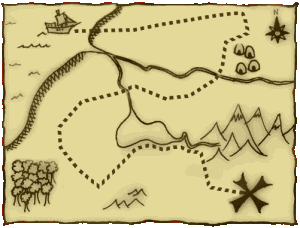
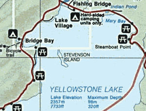
- Maps use map symbols to represent real-world things, such as buildings, trails, roads, bridges, and rivers.
- Maps use colors to share more information. Blue often means water, green means forest, and white means bare land.
- A map has a Legend which lists the symbols it uses and what they mean.
- A grid of imaginary lines wrap around and over the earth. These lines are called Latitude and Longitude and can identify the exact location of any point on earth.
Basic Map Parts
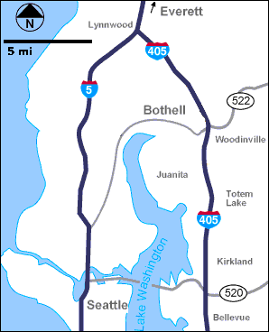
This simple road direction map contains a lot of information:- North is marked in the upper-left corner so you know which way this map relates to the world.
- The Scale is marked. One inch equals 5 miles, so you can tell it is about 15 miles from Seattle to Woodinville.
- Main roads are included so you can find the best route direction between two locations.
- Roads are labeled so you know what to look for when navigating.
- Bodies of water are colored blue.
Maps or Photos
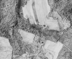
The topo map on the right represents the land in the aerial photo on the left. Notice the buildings and roads on the map can be seen in the photo. Move your mouse over the photo to see the objects highlighted.
A navigation map is actually more useful than a photograph since it can highlight important items and ignore clutter like trees and shadows.
Shaded Relief Maps
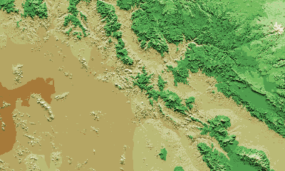
Adding shading to denote shadows thrown by the sun and colors to denote elevation change, beautiful and somewhat realistic maps can be created. The example above shows a high mountain in white in the NorthEast (upper-right) with elevation dropping to a low, flat plain in the SouthWest (lower-left). Mountains, ridges, cliffs, canyons, and plateaus can all be identified.
Shaded relief adds depth and interest to a map, but more is needed to make a map truly useful to us hikers and explorers for navigating wild areas.
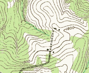
Contour Lines
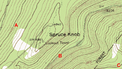
Contour lines are extremely important for outdoors dudes so you know what to expect a mile ahead on the trail. Contour lines show the elevation changes of the terrain. These are called Topographic Maps because they show the topography of the land.
In this example, the elevation at the spot marked A is about 4400 feet above sea level as indicated on the contour line close to it.
The elevation of B is a bit more difficult to figure out, but if you look closely, you might figure out that it is about 4350 feet.
Map is a piece of paper of a booklet where information about roads and places are given with correct measurement. It is essential that you should buy only latest map to avoid getting stuck in a place which has no right information on the map.
ReplyDeleteBest Regards,
Great Journeys